BarcelonaThe episode of rain and snow that began over the weekend will reach its peak in the coming hours. Both Monday and Tuesday will be under the influence of the storm. HarryThis Mediterranean storm will bring easterly winds to our country, generating abundant rainfall, heavy snowfall in the eastern Pyrenees, and very rough seas along the entire coast, especially the Costa Brava and the central coast. It’s raining on already saturated ground, which is why several reservoirs in the inland basins, which are practically full, continue to release water to make room for the new rainfall. Over the weekend, more than 100 l/m² accumulated in regions like Conca de Barberà and Priorat, and more than 80 or 90 l/m² were recorded in Camp de Tarragona. In the western Pyrenees, new snow depths exceeded 90 cm in Boí (2,500 m) and 60 cm in Espot (2,400 m). You will find more data and records of rainfall and snowfall at the end of this report.

Monday: the easterly storm arrives
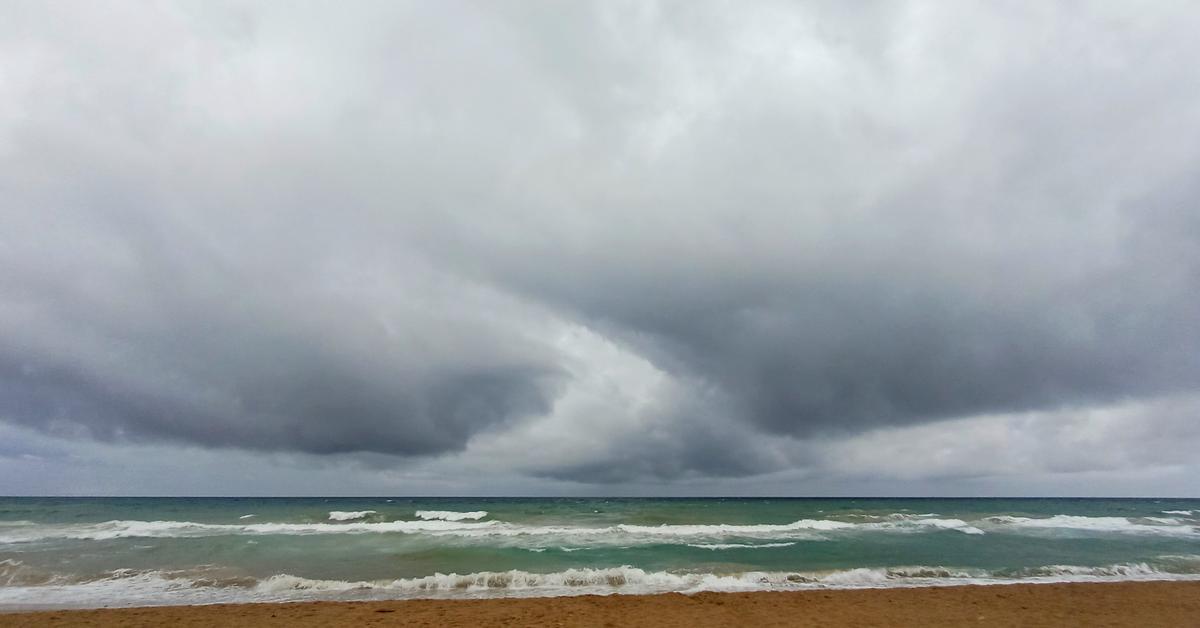
The formation of the Mediterranean storm Harry It will bring humid northeasterly and easterly winds, generating rain across the country, severe sea conditions, and snowfall. During the morning, the brunt of the storm will affect the Girona and northern Barcelona regions, but rain could quickly reach any point throughout the day. Furthermore, the sea conditions will intensify and become very rough along the entire coast, with waves that could exceed 4 to 6 meters in height on the Costa Brava, where a red alert is in effect for high surf. Meteocat also has warnings in place for heavy rain and accumulations of more than 100 liters per square meter in just 24 hours, primarily in northeastern regions of the country.
During the afternoon, the maritime storm will intensify, bringing heavy rain with accumulations approaching 100 l/m² in Montseny-Guilleries, La Selva, and, for example, in Alt Empordà, La Garrotxa, and the easternmost part of Ripollès. It will be cold and damp in the mountain regions and cool elsewhere, with highs generally between 8°C and 14°C.
Also, be aware of the significant snowfall expected in the eastern Pyrenees above approximately 1,400 to 1,500 meters. The higher elevations of Ripollès, Vallespir, and Conflent could accumulate nearly a meter of new snow throughout the event, so Meteocat has issued an alert for Ripollès for snow depths of more than 20 cm above 1,400 m.
Civil Protection maintains the Inuncat and Neucat plans on alert due to the expected heavy rain and snowfall. The Allaucat plan is on pre-alert due to a avalanche danger strong (4) in the Ribagorçana-Vall Fosca, the northern slope of the Cadí-Moixeró and the Ter-Freser.

Tuesday: the storm’s grand finale
Between Monday night and Tuesday, the storm will reach its peak, with widespread and heavy rainfall in the Girona and Barcelona regions, locally with downpours or accumulations of over 100 l/m² in just half an hour. Heavy snowfall will continue in the eastern Pyrenees, while rough seas will affect the entire coast. Rain is also possible in the rest of the country, although less so, with gusty winds from the northeast and east. It appears that Wednesday will bring much calmer weather and the storm will gradually subside, but the weather will not clear. We can expect the rest of the week to see new Atlantic fronts bringing some precipitation, especially in the Pyrenees and the west. But nothing like that long, four-day storm of rain and snow.


Rainfall total up to 24h on Saturday, in l/m²:
- Siurana Swamp: 110
- La Riba: 105
- Prairies: 92
- Constantine: 94
- Balaguer Bone: 82
- Blancafuerte: 81
- Vilanova de Meià: 81
- Tarragona: 79
- Temple: 75
- San Salvador de Guardiola: 69
Rainfall and snow accumulation total up to 7 p.m. on Sunday, in l/m²:
- Portbou: 39
- Paredes del Vallés: 38
- Granollers: 34
- English: 32
- Santa Coloma de Farners: 32
- Viladrau: 27
- San Lorenzo Savall: 27
- Boí (2,500 m): 93 cm (weekend total)
- Spot (2,500 m): 70 cm (total for the weekend)