The influence of a La Niña pattern led to a rollercoaster year of weather across South Carolina, marked by sharp swings.
The year started off snowy with record amounts of precipitation along the coast, only to finish with a holiday heat wave as temperatures neared record highs.
An unusual tropical cyclone season resulted in no hurricane threats for the Eastern Seaboard, but the Palmetto State was the only region to see a direct strike by a named storm.
Perhaps the most prolonged and consequential weather story of the year was the persistent drought.
Conditions ebbed and flowed throughout the year, setting the stage for deteriorating crop conditions and wildfire activity.
Among the most notable events were the following weather stories that defined South Carolina’s climate.
1. January snowstorms
January was an exceptionally snowy month for the U.S., with frozen precipitation extending all the way south to the Gulf Coast and the East Coast.
The Palmetto State experienced two winter weather events, though not every location saw record-breaking snowfall.
A storm system from Jan. 10-11 produced snow in the higher elevations and along the South Carolina-North Carolina state line, while a system later in the month produced record-breaking snowfall along the coast.
That’s right – coastal communities saw more snowfall than inland cities such as Columbia and even Greenville.
With the secondary system, a weather observation site in downtown Charleston reported 4 inches of snow, while some communities farther north recorded between 4 and 6 inches.
Even more impressive snowfall totals were reported along the Gulf Coast’s Interstate 10 corridor, where some communities measured more than a foot of snow, with some areas placed under Blizzard Warnings.

2. Spring wildfires
South Carolina’s wildfire season typically peaks in late winter and early spring due to a lack of rainfall and dry vegetation, and that was certainly the case in 2025.
Fires erupted in March from the Upstate to the Grand Strand, forcing thousands of residents from their homes.
State officials reported that the Table Rock Complex Fire burned more than 13,000 acres in the Upstate, making it the largest mountain wildfire in the state’s history.
A combination of rugged terrain and windy conditions made the fire difficult for firefighters to control after it was sparked by discarded cigarettes.
Significant fires were also reported in Horry, Georgetown, Greenville and Pickens counties, and Governor Henry McMaster declared a state of emergency.
Despite the infernos across the state, there was not a reported loss of life, and damage to structures was minimal.

AP
/
Horry County Fire Rescue
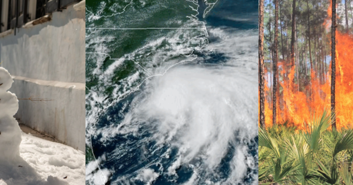
3. July landfalling tropical system
South Carolina was the only state to experience a tropical cyclone landfall in 2025, making it an unusual year for the Atlantic hurricane season.
Tropical Storm Chantal made landfall on July 6 near Litchfield Beach, South Carolina, but much of the July 4 holiday period was considered a washout due to passing rain showers and dangerous rip currents.
The highest reported wind gust in the Palmetto State was 56 mph, but it was the torrential rainfall that caused most of the problems.
Overall, the storm was responsible for six deaths in neighboring North Carolina, with regional damage estimates totaling around $500 million.

4. Cool August
South Carolina saw its coolest August maximum temperature on record, with an average of just 84.8 °F, which was 4.4 °F below average.
Overall, the mean temperature was the seventh-coolest August in more than 130 years of records.
Waves of moisture, in combination with the location of the primary ridge of high pressure, allowed for the unusually cool month.
Despite the cool August, June and July were relatively warm, which balanced out meteorological summer.

5. November arctic blast
An arctic blast brought the earliest snow flurries on record to portions of the eastern Carolinas on Nov. 10.
The winter disturbance began over Canada before dipping southward and encompassing much of the United States.
According to the National Weather Service, a weather balloon about 10,000 feet above Greensboro, North Carolina, reported an air temperature of around -18°C, which was the coldest on record so early in the season.
Typically, -12°C and below is sufficient for snow, but a lack of moisture prevented widespread snowfall reports.
The composition of the air resulted in surface temperatures dropping into the 20s across South Carolina, with some communities setting daily records for the date.
Over a period of less than 72 hours, Charleston dropped from temperatures in the 80s to a record cold low of 29 degrees.
